


Voting District 21305, Contra Costa County, California
About
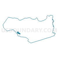
Outline

Summary
| Unique Area Identifier | 529710 |
| Name | Voting District 21305 |
| County | Contra Costa County |
| State | California |
| Area (square miles) | 3.28 |
| Land Area (square miles) | 3.28 |
| Water Area (square miles) | 0.00 |
| % of Land Area | 100.00 |
| % of Water Area | 0.00 |
| Latitude of the Internal Point | 37.85692090 |
| Longtitude of the Internal Point | -122.17178020 |
Maps


Graphs
Select a template below for downloading or customizing gragh for Voting District 21305, Contra Costa County, California


Neighbors
Neighoring Voting District (by Name) Neighboring Voting District on the Map
- Voting District 21205, Contra Costa County, CA
- Voting District 21206, Contra Costa County, CA
- Voting District 21225, Contra Costa County, CA
- Voting District 21230, Contra Costa County, CA
- Voting District 21245, Contra Costa County, CA
- Voting District 21290, Contra Costa County, CA
- Voting District 21310, Contra Costa County, CA
- Voting District 21315, Contra Costa County, CA
- Voting District 21320, Contra Costa County, CA
- Voting District 21321, Contra Costa County, CA
- Voting District 21325, Contra Costa County, CA
- Voting District 21420, Contra Costa County, CA
- Voting District 21520, Contra Costa County, CA
- Voting District 21535, Contra Costa County, CA
Top 10 Neighboring County Subdivision (by Population) Neighboring County Subdivision on the Map
Top 10 Neighboring Place (by Population) Neighboring Place on the Map
Top 10 Neighboring Elementary School District (by Population) Neighboring Elementary School District on the Map
- Orinda Union Elementary School District, CA (17,693)
- Moraga Elementary School District, CA (16,195)
- Canyon Elementary School District, CA (237)
Top 10 Neighboring Secondary School District (by Population) Neighboring Secondary School District on the Map
Top 10 Neighboring State Legislative District Lower Chamber (by Population) Neighboring State Legislative District Lower Chamber on the Map
Top 10 Neighboring State Legislative District Upper Chamber (by Population) Neighboring State Legislative District Upper Chamber on the Map
Top 10 Neighboring 111th Congressional District (by Population) Neighboring 111th Congressional District on the Map
Top 10 Neighboring Census Tract (by Population) Neighboring Census Tract on the Map
- Census Tract 3540.02, Contra Costa County, CA (6,590)
- Census Tract 3522.01, Contra Costa County, CA (5,750)
- Census Tract 3530.02, Contra Costa County, CA (4,078)
- Census Tract 3530.01, Contra Costa County, CA (3,521)
- Census Tract 3522.02, Contra Costa County, CA (2,548)
- Census Tract 3540.01, Contra Costa County, CA (1,859)